
DOWNLOAD THE APP


Customer Services
Copyright © 2025 Desertcart Holdings Limited
DOWNLOAD THE APP


🎯 Elevate your drone mapping game with targets that never miss the mark!
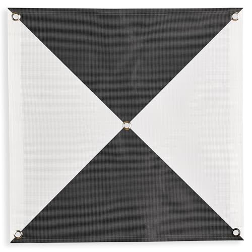
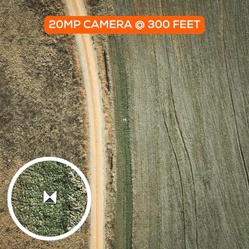
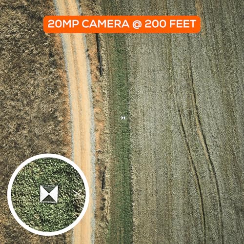
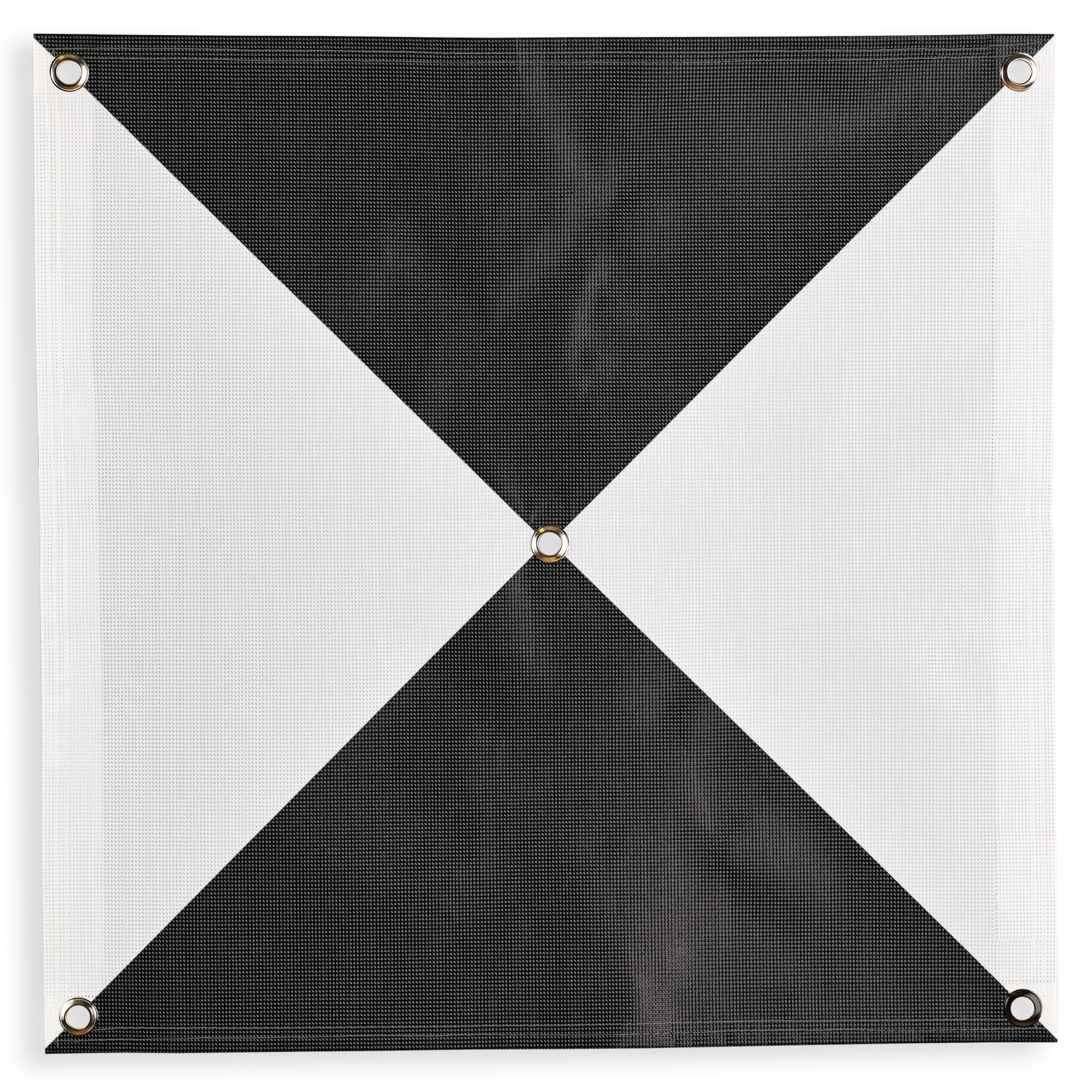
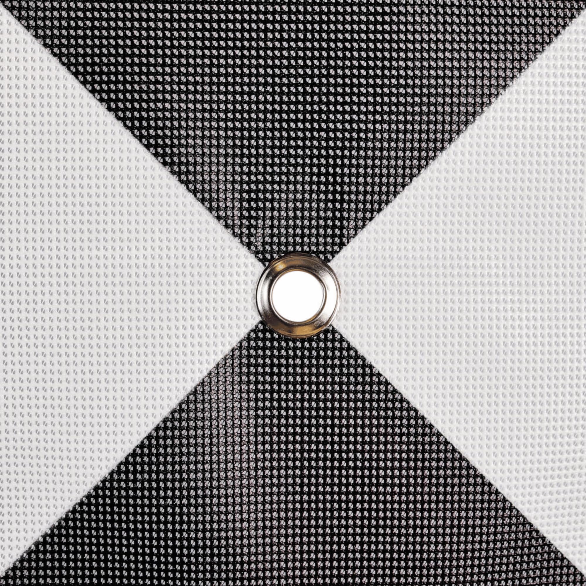
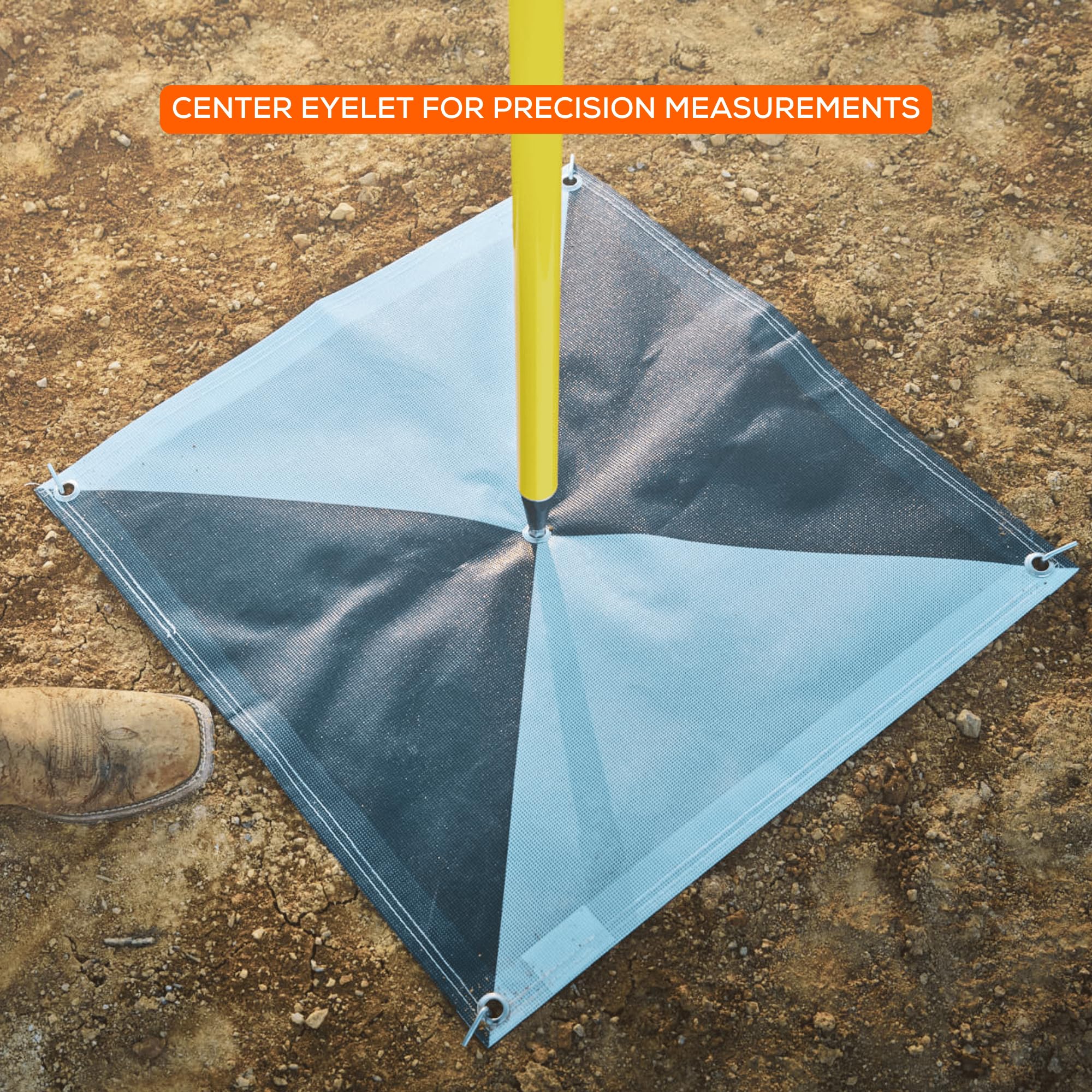
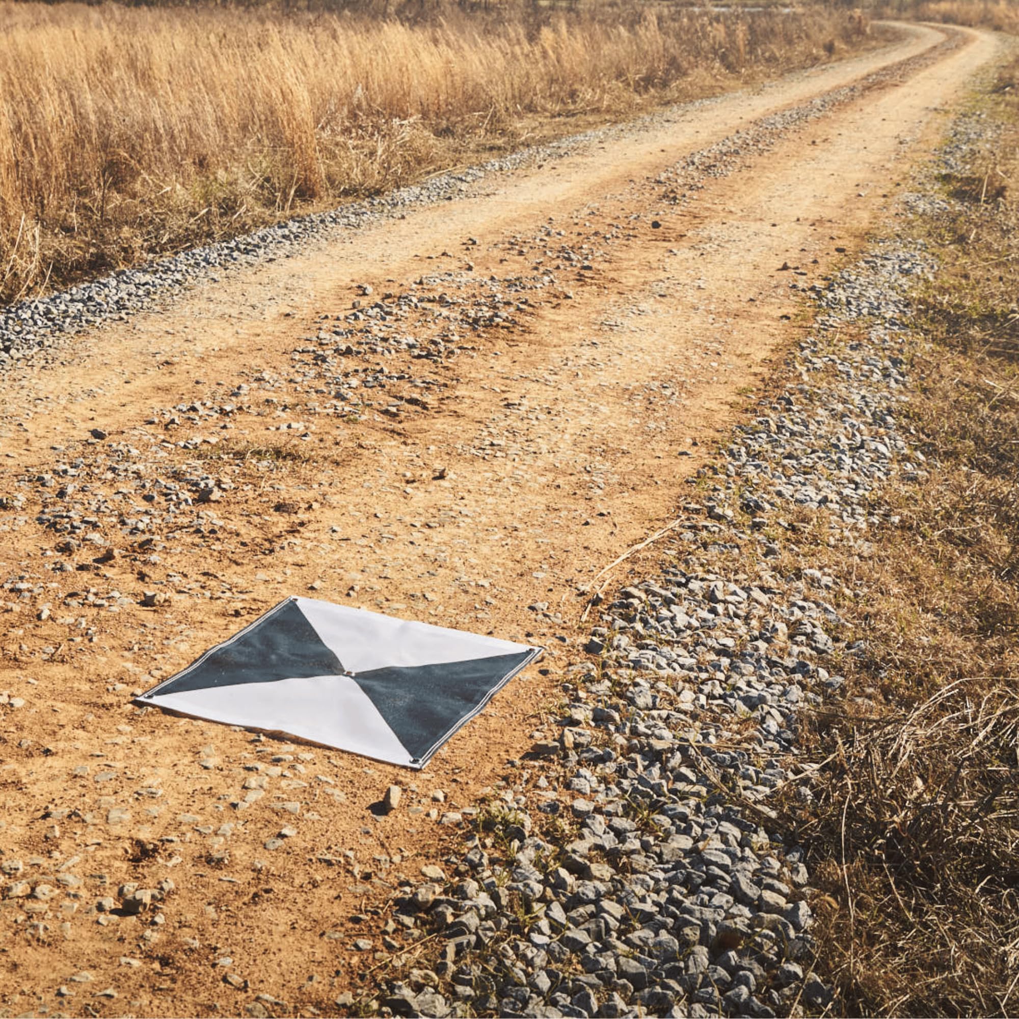
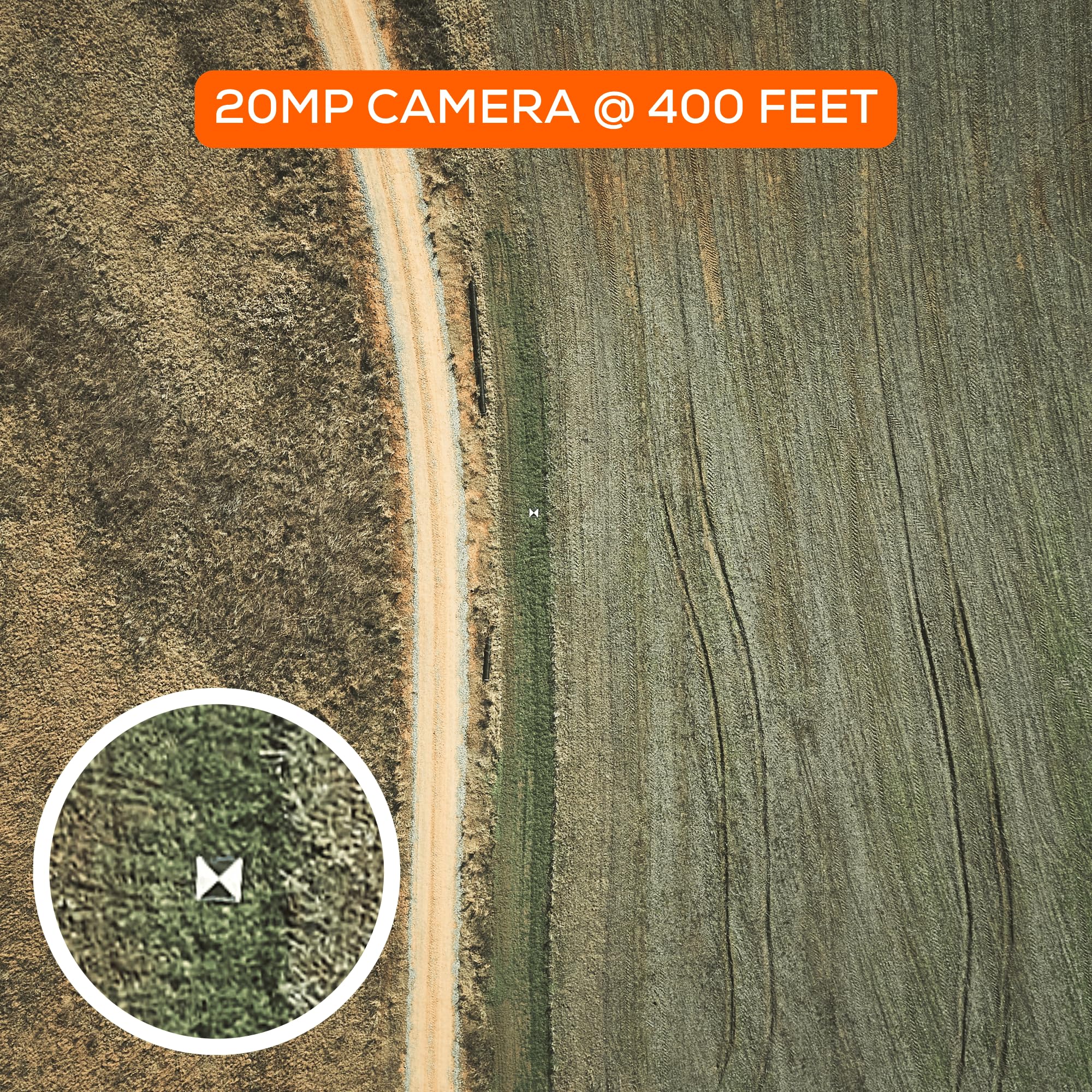
The Sky High Bull's-Eye 24”x24” Drone Ground Control Point is a professional-grade UAV aerial target designed for precise mapping and surveying. Featuring a high-contrast black/white pattern for optimal visibility, four corner eyelets for secure ground placement, and durable lightweight construction, it ensures reliable, repeatable data capture. Compatible with leading drone mapping software like Pix4D and DroneDeploy, this target is ideal for civil engineers, surveyors, and drone professionals seeking accuracy and efficiency in their aerial projects.


| ASIN | B0DQ3C3JCC |
| Best Sellers Rank | #50,997 in Industrial & Scientific ( See Top 100 in Industrial & Scientific ) #48 in Unmanned Aerial Vehicles (UAVs) |
| Date First Available | December 11, 2024 |
| Item Weight | 2 pounds |
| Manufacturer | Willis Worxs |
| Product Dimensions | 24 x 24 x 0.2 inches |
S**O
Excellent tool for drone mapping
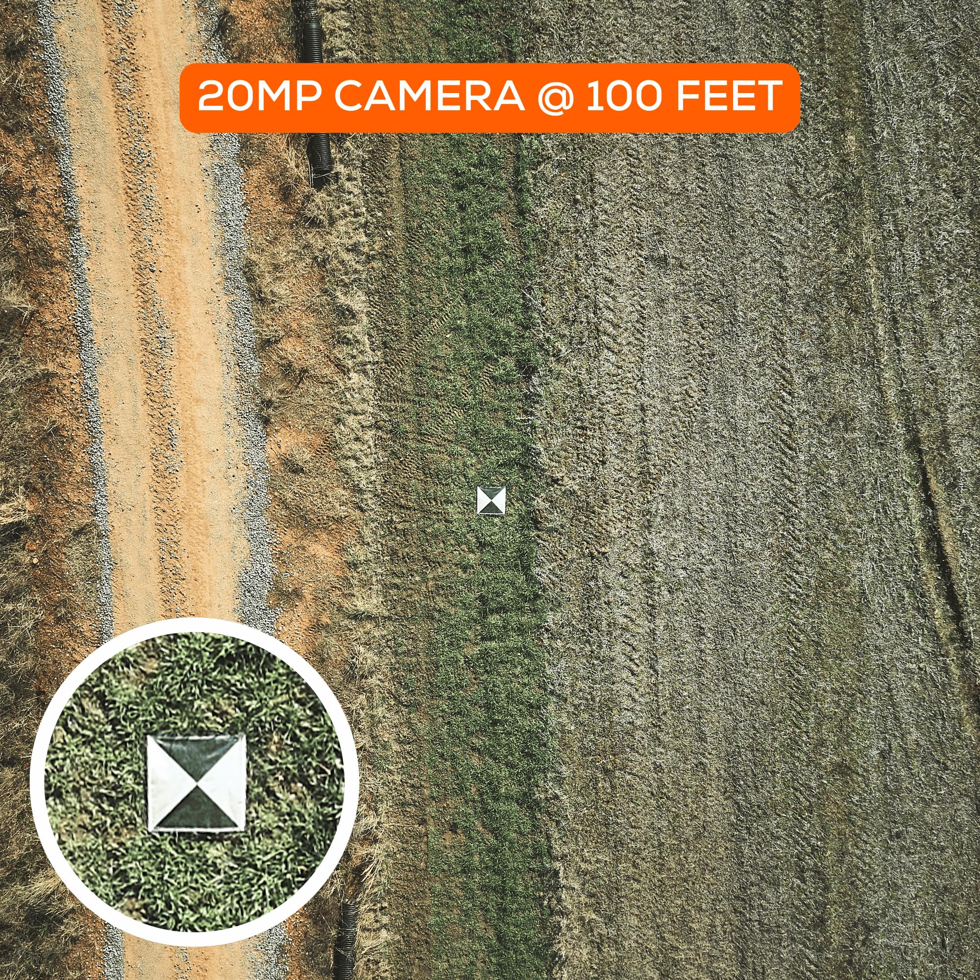
Professionally, I am a Civil Engineer and I like to use drone technology for mapping. I had a personal mapping project of my property where I wanted to track some progress of trail construction and align it with my property boundary. I was able to situate these at multiple property corners, fly my drone over the area for mapping and clearly see these targets on the ground; even in wooded areas (flew in the winter with no leaves). These specific targets do not have the larger center hole for property pin centering, but what I did was put the 'numbered' square corner up to the center of the pin and then staked down my corners to hold the target firmly in place. This allowed me to fly the property and know that the numbered squares are the corners - which is a consistent way to align the map with my boundary survey. I flew at 185 ft (1.5cm/pixel for DJI Phantom 4) - I have trees I have to clear and 190' of topographic relief on the property). The numbers were very easy to read at this elevation. Since my 185' was fixed, down in the low points of the property, I was over 350' of elevation delta between the drone and target - still readable! I then flew at 235' feet (2cm/pixel) and still readable - at over 400' in elevation to the target. This target was also in a wooded area. The targets are durably made. I can see them lasting for a lot of uses. I can also see that if a construction company wanted to monitor a job site over a period of time, these can likely withstand staying in the field for a few months - they might fade under UV light based upon the material type; but they are inexpensive to replace. You can possibly stake these down with better stakes - or mount to a hard surface with fasteners and even have an elevation target to use. Overall - if you are doing drone mapping, these are a better tool than some of the 'homemade' solutions - especially at the price of plywood materials and paint; I would definitely recommend them. They are inexpensive solutions that provide reasonably accurate results.
T**B
UAS&Manned Aerial Survey Targets
I’ve purchased hundreds of these for our remote sensing projects. Great quality and fast shipping. We prefer the 48x48 because it’s easier to see in the LiDAR data. I wish they would do away with the center eyelet and make it triangular flaps to the center. That’s what I normally have to rip out the second I get them so my nail doesn’t get disturbed picking them back up.
T**1
Good targets for RTK requirements
Very sturdy and well thought out.
S**D
Great product!
Love these targets! Haven’t frayed, ripped, or become less useful in any way. Used roughly under land dev work and still performs. Good ad hoc takeoff/landing pads, too.
L**M
Great targets, cheap stakes.
Much easier to pick out than any of the home made solutions I’ve used. 4 stars because the stakes that come with are useless junk.
B**E
Easily Seen
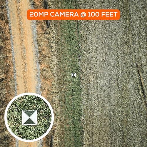
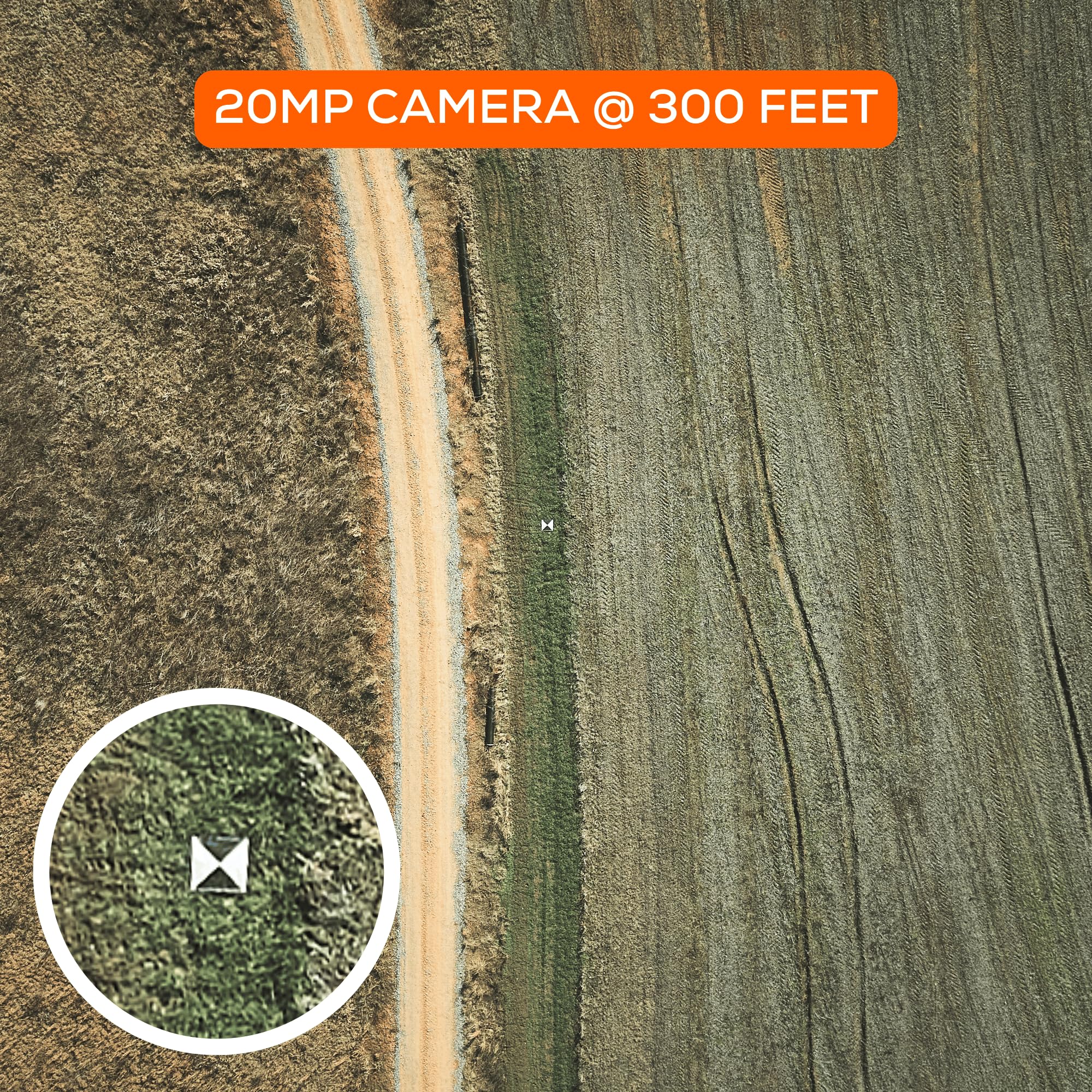
Bought these for work. They work great and can be seen on LiDar flights we do. Easily seen from 100-400 AGL
A**A
Resistant, very good contrast and clearly visible from the air
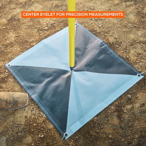
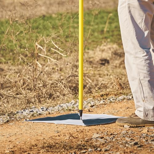
Nothing to dislike so far, particularly in unconsolidated terrain (soil/sand). I have used it as ground control points in photogrammetric UAV flights. The material is light, so it is easy to carry. The center has a hole minimizing damage with topographic poles. Corners have metal seal rings to fix the target to the ground using stakes. I am very pleased with this product.
A**.
good quality and workmanship.
these work nicely out in the field and I expect them to hold up over time
A**S
No complaints
C**S
Super !!!!
C**I
Recomendado, excelente puntos de control para drone, muy buen servicio y rapidez en la entrega, gracias
C**H
Seem a little expensive but they'll do the job!
D**O
Its made of some kind of mesh. Very good quality and does not take much space as you can fold it. Easy to carry to any projecy
Trustpilot
1 month ago
2 weeks ago