

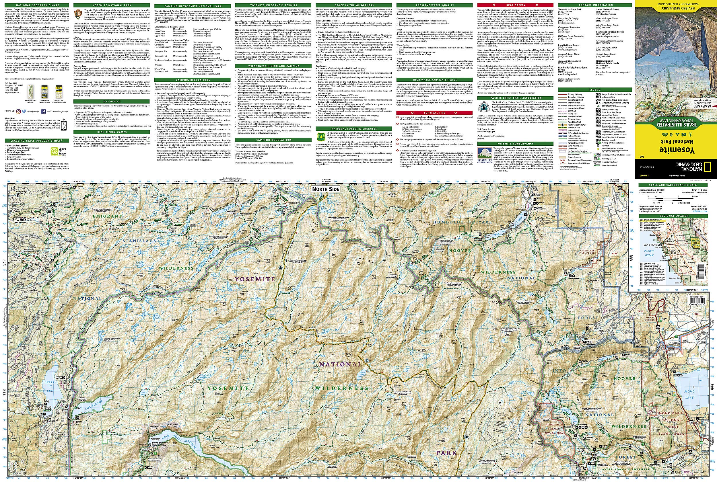
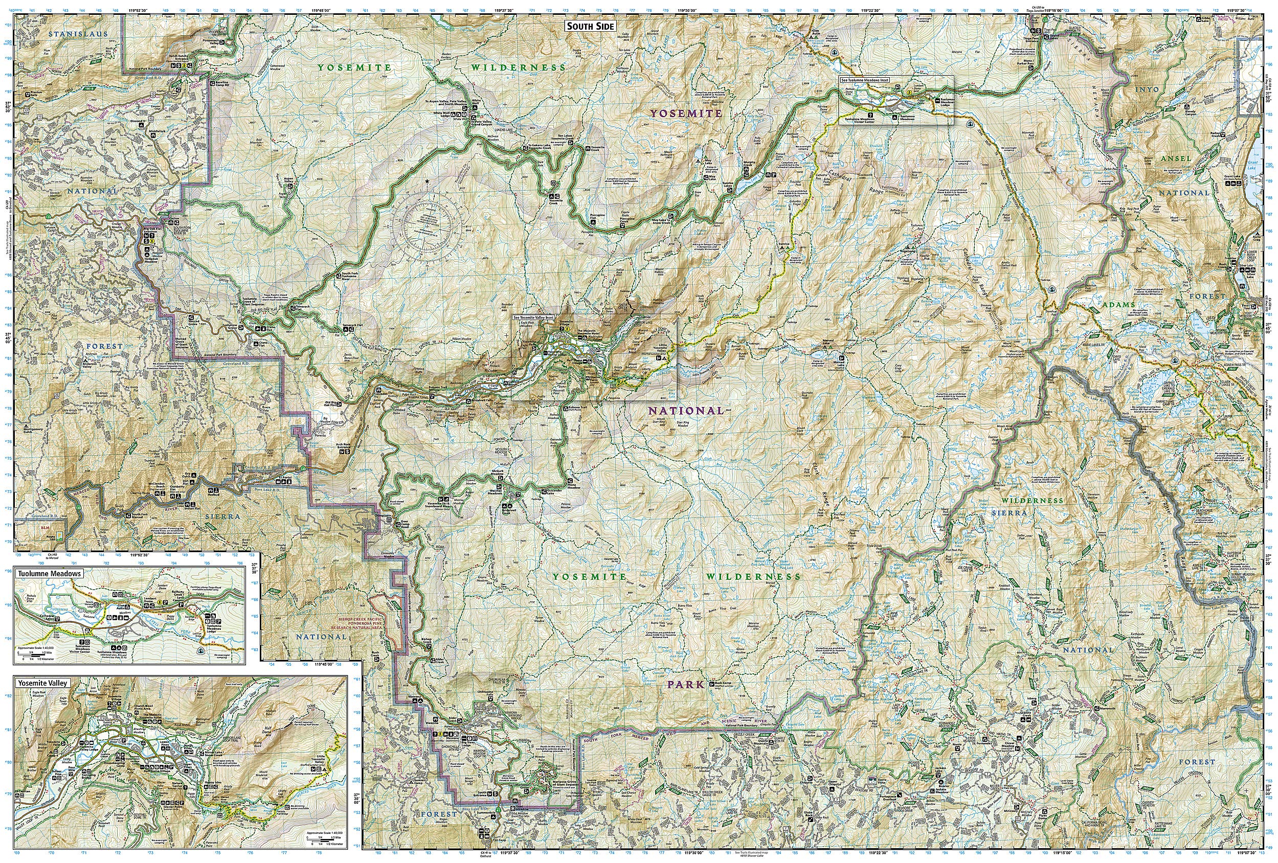


Full description not available

N**)
Easy to Read with Sufficient Details
I'm a long time Scouter and like having maps in addition to my trail apps. This is a durable map that greatly supplemented my digital navigation.
M**E
Great map, super resistant
Waterproof + containing a lot of details. Perfect to plan the trip and while hiking.
J**R
Great map
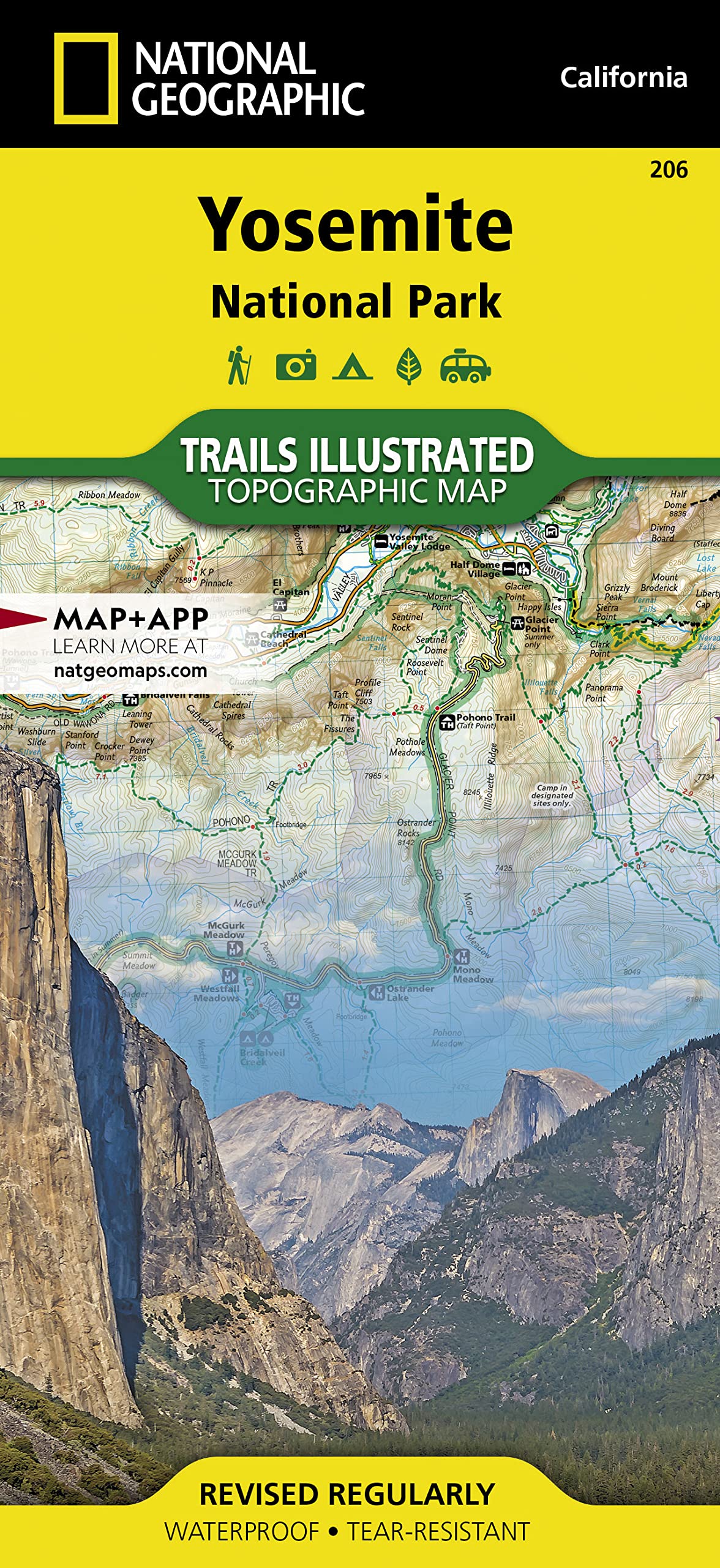
We used this map for a backpacking trip in Yosemite this summer. We were also pleased to see that this was one of the maps they were selling in the ranger station. We used this map for planning our trip and brought it as reference throughout. The map is a little big, but that’s fine. We appreciated the insets for specific locations.
K**R
Yosemite map
Map was very useful, best for avid hikers. The free park map given out at the entrance was easier to navigate though for first time visitors.
N**H
Spit on
These maps are spot on. When your on the mountain, service can be spotty or even none. This map guided us 65 miles across Yosemite in 11 days backpack camping. Held up to water, held up to being opened and folded probably 100 times. Elevation was correct, mileage. Everything. I framed it with a bunch of pictures we took and drew out the route we did.
F**R
Helpful map, especially for such a massive park like Yosemite!
Now this is a must have. The park is just massive! Absolutely have to have the map, I haven’t visited the park yet, so I cannot really comment on accuracy and helpfulness, but with all the trails out there, especially the wilderness ones, I don’t see how anyone would make it without GPS and a plan B for when GPS doesn’t work. They will probably need to update the map once construction on some of the trails are complete, I know the trams are finally gone so we can go back to a natural trail setting with much more peace and quite, that’s the way it has to be to make sure we keep it the way we found it! Support your national parks! They are the best!
K**R
have lots of great information. They are waterproof and extremely durable
Anytime I go to a National Park, I always get at Nat Geo map. First of all, do not back country hike without a topographical map. My wife and I hiked the Grand Canyon without one, and we nearly missed our first water stop because we couldn't figure out where on our internet printed map we were. Lucky for us, when we did find our water stop there was a guy who lent us his Nat Geo map for the rest of our hike. These maps are detailed, have lots of great information. They are waterproof and extremely durable.
S**S
Great map of Yosemite!
This map was just what I was looking for. It's big and easy to read!
Trustpilot
1 week ago
1 month ago